|
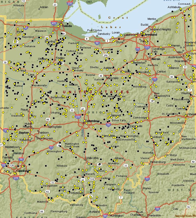
Bridge Locations The map illustrates the state wide distribution of all 956 bridges listed on this website as of 6/6/2008. The yellow dots are the 496 bridges on the Bridge List. The black dots are the 460 bridges on the Lost Bridges List. Microsoft, Streets and Trips users can download the corresponding map-file for their personal use by left-clicking the map. This file can be zoomed to provide road level detail of the bridge locations and is useful for planning routes to groups of bridges. The county pages of the Bridge Gallery link to composite maps of all the bridges in each county and are similarly useful for planning trips to the existing bridges within a county. Directions to individual bridges are provided in the bridge and gallery tables. For this service just click on a bridge's location entry to link to a Google Map. |
|---|
|
|
|
|