|
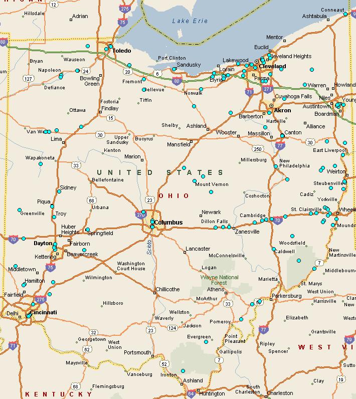
Arch Bridge Locations The cyan dots on the Ohio map indicate the state wide distribution of the 128 extant concrete and stone arch bridges listed on this website as of 6/6/2008. Microsoft, Streets and Trips users can download the corresponding map-file for their personal use by left-clicking the map. This file can be zoomed to provide road level detail of the bridge locations and is useful for planning routes to groups of bridges. Maps and directions to individual bridges are accessed in the arch bridges table. Click on a bridge's location entry to link to a Google Map. |
|---|
|
|
|
|